Walk and Ride Orange
Consultation has concluded

Shaped by expert consultants and the results of a community survey, the plan aims to help make Orange a walking and bicycle-friendly community.
The plan, which includes a number of recommendations to guide future development, was on public exhibition for community comment.
That period for comment has now ended, but this site remains active as a source of information and engagement about the latest developments.
After considering community comments, Orange City Council adopted the plan.
On this site you can :
- download the entire document
- read articles about some of the key recommendations
- find out about a review of regional cycling routes, and have your say.
- While the survey has now ended, you can leave comments on the online forum
- or click a pin on a map to comment on proposed cycling routes
-
Councillor checks out proposed new lane widths
Share Councillor checks out proposed new lane widths on Facebook Share Councillor checks out proposed new lane widths on Twitter Share Councillor checks out proposed new lane widths on Linkedin Email Councillor checks out proposed new lane widths link
The Active Travel Plan (ATP) proposes channeling bike and pedestrian traffic towards a number of key north-south and east-west traffic routes, to ease their journey to and from the Orange CBD.
It’s proposed that on these key routes :
- Car traffic would be restricted to a 3.2 metre lane in either direction in the centre of the road
- A dedicated and marked 1.5 metre bike lane would be installed on either side of the central car traffic lanes.
- Car parking as usual on the edges of the road.
City of Orange Traffic Committee chair, Cr Russell Turner checks out how wide these proposed lanes would be, and what difference it would make for passing traffic.These key routes would include sections of :
- North-south : Hill, Anson, Edward, McLachlan, Lone Pine
- East-west : Kite, Byng, Dalton, Icely and Coronation
 The first roads where the new lane markings wold be installed would be Anson (north-south) and Kite & Coronation (east-west).
You can also see a map of other roads where the new pattern of bike and traffic lanes is being considered.
Have your say on the Active Travel Plan by filling-in a survey or leaving an online comment.
-
New plan proposes cut to CBD speed limit
Share New plan proposes cut to CBD speed limit on Facebook Share New plan proposes cut to CBD speed limit on Twitter Share New plan proposes cut to CBD speed limit on Linkedin Email New plan proposes cut to CBD speed limit link
A proposed new planning blue-print aimed at encouraging Orange residents to get out of their cars more often and instead walk, ride a bike or catch a bus, is up for community discussion.
City of Orange Traffic Committee chair, Cr Russell Turner believes the proposed changes are worth exploring in the interests of community health and reducing traffic congestion.
“There’s a lot of evidence which points to the potential health problems when people drive to work, sit at a desk all day, drive home again and then sit on the couch,” Cr Russell Turner said.
“Less children too are riding a bike to school and are instead being driven or catching a bus. This study has pointed to a string of obstacles in Orange that stop both adults and children riding a bike or walking more often.”
“Some of the plan’s proposed solutions might be controversial, but I’m confident that it’s a step in the right direction if its gets Orange residents travelling and living more actively.”

SPEED LIMIT PROPOSAL : City of Orange Traffic Committee chair, Cr Russell Turner wants to see community discussion about a plan to introduce a new lower speed limit in the Orange CBD.
The Active Travel Plan (ATP) finds that around 11,600 people are travelling between 2 and 5 kms to work each day in Orange, mostly by car.
The key directions of the Active Travel Plan are about making a number of main north-south and east-west routes in Orange much more bike-friendly, as well as making the CBD safer for riders and pedestrians.
Among a raft of measures the Active Travel Plan includes proposals to :
- Cut the speed limit in Orange’s CBD from 50 to 40 kms/hour.
- Narrow the width of car lanes in a number of key Orange streets and position new bike lanes on either side of the road.
- Adopt a range of other planning principles aimed at making Orange even more bike-friendly
The ATP suggests adopting a range of umbrella strategies that are part of the NSW Premier’s Council for Active Living guidelines.
These guidelines which among the rationale for the recent switch by Sydney’s CBD from 50 to 40 km/hour.
“These measures are worth considering. If Orange was able to increase its percentage of commuters who ride a bike from 2 percent to 5 percent, it would take 500 cars off the road every day,” Cr Russell Turner said.
Orange City Council has placed the Active Travel Plan exhibition for comment for one month. The plan was drafted by transport consultants after a round of community consultation late last year.
The deadline for community comment is Friday 6 May.
You can have you say by :
- making a formal submission
- filing in an online survey, or
- leaving an online comment
-
What stops you riding to work?
Share What stops you riding to work? on Facebook Share What stops you riding to work? on Twitter Share What stops you riding to work? on Linkedin Email What stops you riding to work? link
Despite Orange’s flat or gently-sloping streets only 5% of adults walk to work and only 2 per cent ride a bike, according to research conducted to compile the Active Travel Plan (ATP).
The study looked at how to fix the barriers that would encourage more people to walk or cycle more often. If solutions were found, the end result would be extra capacity in Orange’s transport networks in inner city areas.
In a survey of Orange residents, the 3 most cited reasons for not walking more often were :
- No marked or dedicated footpaths
- Footpaths in poor condition
- Lack of pedestrian crossings on busy streets
Other reasons include the required distance being too far to walk, or weather conditions.

The top 2 reasons given in the survey for not riding a bike in Orange were :
- The attitude of drivers
- Paths and streets weren’t safe or comfortable to ride on
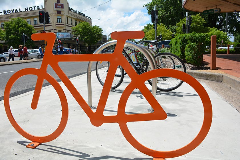
STABLING : Secure bike racks nearby to public buildings in Orange, such as the Orange City Library, are being installed to encourage residents to ride bicycles more often.
Orange City Council has placed the Active Travel Plan exhibition for comment for one month. The plan was drafted by transport consultants after a round of community consultation late last year.
You can have you say by :
- making a formal submission
- filing in an online survey, or
- leaving an online comment
-
Ride a bike to school?
Share Ride a bike to school? on Facebook Share Ride a bike to school? on Twitter Share Ride a bike to school? on Linkedin Email Ride a bike to school? link
The Active Travel Plan (ATP) is looking to fix the barriers which currently prevent local children and teenagers riding bikes to school.

A case study found the barriers include :
- Parents are concerned about car traffic and the availability of low-risk routes for their children to ride to school
- Disconnected or incomplete bile lanes near their school
- Concerns about weather
A study commissioned as part of the ATP found that there are around 8,100 students in Orange’s 19 schools.
The study found that only about 1 in 5 students (22%) use an active option to travel to school.
The travel to school choices were :
- School bus 47%
- Car 30%
- Walking 17%
- Bike 3%
- Scooters or skates 2%
The study recommended Orange City Council work with schools to :
- Construct more footpaths
- Improve nearby bike lanes
- provide programs to participate in active travel, including providing maps of ‘quiet neighbourhood routes to schools
Draft maps are being prepared for a number of schools including this map from Bowen Public School, (18 MB) which outlines preferred routes for children to use as they travel to and from school.
Among other measures the ATP suggests measures to remind parents that children aged 12 and under are legally allowed to ride their bike on footpaths.
Orange City Council has placed the Active Travel Plan exhibition for comment for one month. The plan was drafted by transport consultants after a round of community consultation late last year.
You can have you say by :
- making a formal submission
- filing in an online survey, or
- leaving an online comment
-
Would new lower speed limit boost safety ?
Share Would new lower speed limit boost safety ? on Facebook Share Would new lower speed limit boost safety ? on Twitter Share Would new lower speed limit boost safety ? on Linkedin Email Would new lower speed limit boost safety ? link
The central Orange area where the proposed new 40 km/hr speed limit would be enforced is still a matter for community consultation. The proposal is for the CBD area bounded by Peisley and Hill Streets, Byng and Kite Streets.
Research compiled by the ATP consultants found that most pedestrians injured by a car that’s travelling faster than 50 kms/hr would not survive the impact. In contrast, the chance of a fatality when a pedestrian is hit by a car that’s travelling at 30 km/hr is 5 per cent. At 40 kms/hr the likelihood of a fatal accident is 20 per cent.
A map in the Active Travel Plan document shows the majority of serious injuries and fatalities in recent years have happened in the centre of Orange and main roads.
LOCATION OF ACCIDENTS IN ORANGE 2009-2013
Many local councils have successfully introduced 40 km/hr sped limits in high-pedestrian activity areas.
When 40 km/hr limits were introduced around NSW schools, this resulted in a 24 per cent reduction in pedestrian and cycle-related crashes outside schools.
Orange City Council has placed the Active Travel Plan exhibition for comment for one month. The plan was drafted by transport consultants after a round of community consultation late last year.
You can have you say by :
- making a formal submission
- filing in an online survey, or
- leaving an online comment
-
New bike lanes proposed for key routes around Orange
Share New bike lanes proposed for key routes around Orange on Facebook Share New bike lanes proposed for key routes around Orange on Twitter Share New bike lanes proposed for key routes around Orange on Linkedin Email New bike lanes proposed for key routes around Orange link
The Active Travel Plan (ATP) proposes channeling bike and pedestrian traffic towards a number of key north-south and east-west traffic routes, to ease their journey to and from the CBD.
These streets would include sections of :
- North-south : Hill, Anson, Edward, McLachlan, Lone Pine
- East-west : Kite, Byng, Dalton, Icely and Coronation
It’s proposed that on these key routes :
- Car traffic would be restricted to a 3.2 metre lane in either direction in the centre of the road
- A dedicated and marked bike lane would be installed on either side of the central car traffic lanes.
- Car parking as usual on the edges of the road.
Under current road rules, ‘When a bicycle lane is marked on the road and has bicycle lane signs, cyclists must use it unless it is impracticable to do so. Although these lanes are for bicycles, cars may use them for not more than 50 metres to enter or leave the road at a driveway or intersection.’
It’s proposed that the changes would happen soon on roads judged to be primary routes (Anson and Kite streets, Coronation Drive) and gradually on secondary routes.(see map)

This preliminary map shows the streets (coloured in PINK) where work would happen first (Anson, KIte & Coronation) and the streets (coloured in YELLOW) which follow in the priority list (Hill, Dalton, Edward, Icely, Ploughmans, McLachlan etc.)
Orange City Council has placed the Active Travel Plan exhibition for comment for one month. The plan was drafted by transport consultants after a round of community consultation late last year.
You can have you say by :
- making a formal submission
- filing in an online survey, or
- leaving an online comment